
SPI OFFERS ULTRA LONG RANGE IMAGING SYSTEMS FOR BORDER PATROL FLIR SCOPE TRUCKS. SCOPE TRUCK AND LONG RANGE ZOOM OPTICS REQUIRE STABILIZED HIGH QUALITY LONG RANGE DAY/NIGHT CAMERAS FOR DETECTION IN EXCESS OF 10 MILES, SPI’s LONG RANGE BORDER IMAGING SYSTEMS ARE IDEAL FOR SCOPE TRUCK & BORDER SURVEILLANCE APPLICATIONS WITH ULTRA EXTREME LONG RANGE DETECTION CAPABILITIES WHILE KEEPING THE IMAGERY ROCK STEADY AND STABLE WHILE VIEWING IN ZOOM TELEPHOTO MODES. SYSTEMS LIKE THE HIGHLY CUSTOMIZABLE M9 and M11 ARE MFG FOR THE EVER DEMANDING SCOPE TRUCK / BORDER SECURITY OPERATOR.

Terrorists don’t care if it’s night, day, rainy or snowy when they attack. That’s why SPI Corp believes that neither should thermal imaging cameras when it comes to security and surveillance.
With threats coming in from all angles, via land, sea and air, homeland security relies on our PTZ/handheld thermal imaging cameras with full pan tilt zoom capability to get the job done in any conditions with no restrictions. Whether mounted on trucks, buildings or UAS & UAV drones, our infrared imaging systems remain a reliable means of detecting human and various other threats from a safe distance away.
Our thermal imaging surveillance cameras work in total darkness and low light conditions, and out perform most night vision systems because they do not require any light to operate as many models of night vision systems do. Our infrared security cameras can also be integrated into existing border security systems to provide the ultimate in surveillance, 24/7.
SPI thermal imaging security systems come with a wide array of options including handheld, mountable, wireless & pan tilt zoom models, some of which also feature full color CCTV cameras for ultimate day time optics coupled with thermal vision. So whether you are a law enforcement officer looking to gain footage for evidentiary purposes, a border patrol agent on the tail of drug traffickers or just need to implement thermal imaging solutions into your existing security regimen, we have many affordable options to offer.
SPI Corp also engineers marine PTZ Flir thermal imaging cameras developed specifically for coastal & waterway surveillance applications. Our maritime infrared camera models come with rugged, sealed weatherized housing and are explicitly suited to maintain boat security, conduct search & seizures and even be utilized in water rescue operations.
There truly is no where to hide from SPI thermal imaging camera systems. Let us develop the best custom thermal imaging solution for you.
Contact us today to learn more about our thermal imaging surveillance cameras. Call (702) 369-3966 in Las Vegas, toll free at (800) 403-2983, or email us at info@uav1.com.
M11 Ultra Long range High Definition High Reliability PTZ FLIR Border Patrol, protection, security and surveillance thermal imaging camera
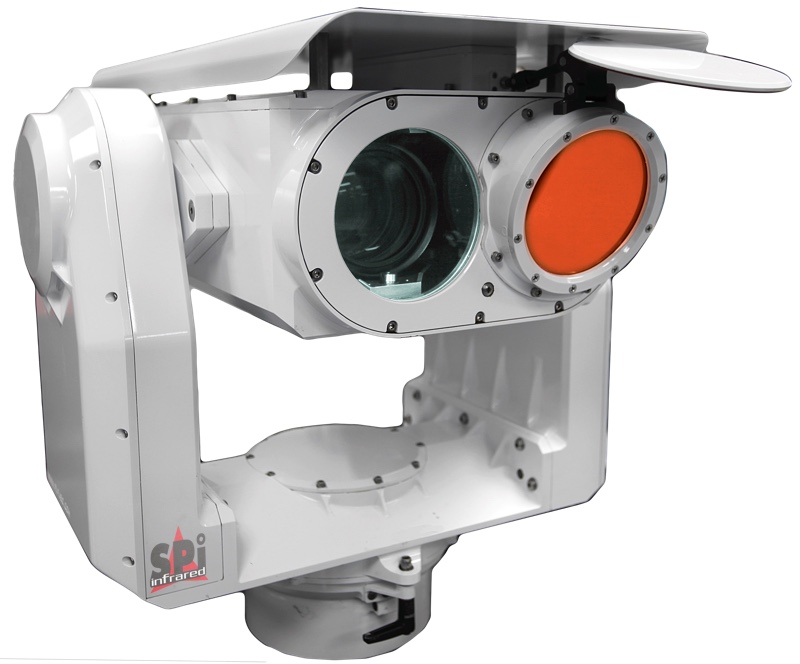
The new SPI multi sensor pan tilt unit M11 is a state-of-the-art high grade multi sensor pan tilt zoom unit that is built with the highest performing products and sensors available. The rugged pan tilt unit is a weapon grade pan tilt gyro stabilized gimbal turret, the multi sensors include long range cooled InSb Mwir FPA thermal imaging Flir detector with extreme long range CZ continuous zoom auto focus lens from 25mm – 1550mm, the daytime visible HD camera is comprised of the lowest light gathering ultra sensitive CMOS sensors with zoom lenses exceeding 3000mm. The unit has add in lrf laser range finders, ir infrared lasers, GPS, compass, and SWIR, NIR and LWIR options.

M9 Ultra Extreme Long Range PTZ FLIR thermal security camera for Border patrol, protection & Security.


Long range cooled PTZ SPI M9/SA all weather imaging system
M9 ULTRA LONG COOLED MWIR THERMAL IMAGING CAMERA IN CAMOUFLAGE COLOR OFFERING

CLICK HERE FOR THE WORLDS LOWEST COST MX6 FLIR PTZ thermal imaging long range multi sensor pan tilt MWIR camera system
NEW LONG RANGE BORDER PAN TILT PTZ THERMAL IMAGING FLIR CAMERAS INTRODUCED

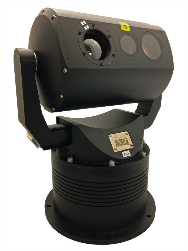
M1D PTZ Thermal Imaging Surveillance Cameras
The M1D Family of pan tilt zoom thermal security cameras give you the ultimate in 360 degree 24/7 situational awareness. Fully equipped with thermal sensors, a laser pointer and CCTV camera, the M1D is a completely weatherized thermal imaging system that mounts just about anywhere, magnetically on vehicles or affixed to marine vessels & UAV drones via hard mounts. The M1D thermal cameras feature ultra-rugged housing and image stabilization with a compact size offering performance & convenience in one small, lightweight package.
These fierce little infrared cameras come in several configurations, including wireless models to offer supreme surveillance capability from a safe distance away in combat zones, border patrol missions or homeland security operations.
M1D Thermal Security Camera Specs
| Dimensions | 6″ X 4″ X 3.5″ |
| Weight | 2lbs |
| Power | 12-28 VDC |
| Pan/Tilt | 360° continuous / 180° +/- |
| Magnification | 2x, 4x, 8x |
| Sensor Types | 640×480, 320×240, 160×120 Thermal FLIR |
M5 Long Range Thermal Imaging Surveillance Cameras
The M5 Family of pan tilt zoom thermal security cameras are available in a variety of configurations to give you the best long range thermal surveillance possible. These multi-sensor PTZ cameras are the hardest working, most rugged security cameras made today, making them the perfect thermal imaging solution for law enforcement and patrol or combat operations. The M5 housing is made to take a beating in any weather or situation, featuring an integrated wiper system for the clearest thermal vision possible.
These long range thermal security cameras are suitable for fixed mounting on vehicles, buildings or marine vessels and can be integrated into your existing infrastructure.

M5 Thermal Security Camera Specs
| Dimensions | 14.6″ x 13.5″ x 13.5″ |
| Weight | 13.2 lbs |
| Power | 12VDC I≥2.5A |
| Ruggedness | Continuous spray 48hours under PH of 6.5-7.2, All weather, sealed |
| Zoom | 455 X zoom CCTV Optical & Digital |
| Detection | >2000M Thermal >6200M Visual |
| Average Work Time | ≥50000hours |

M7 PTZ Thermal Imaging flir Eoir Camera Specifications
MX5 Border patrol, thermal imaging flir PTZ Pan tilt camera for surveillance, FLIR scope truck, security detection applications
MX-5 ULTRA RUGGED PTZ FLIR PAN TILT THERMAL IMAGING SYSTEM
Protecting a country’s frontier, border and coastline is vital to its Homeland Security and protection. It can be very challenging to detect potential intruders or smugglers in total darkness or in diverse weather conditions. Thermal imaging cameras can help border surveillance and security agents to meet the demands they face at night and in other low-light situations. PTZ Thermal imaging FLIR cameras that are specifically designed for border patrol, protection, security and surveillance can be integrated in a border security project with radars and other sensors in a so called “slew-to-cue”, detect, recognize and identify modes. Border Protection systems need to scan wide areas and then zoom in to extreme long ranges and identify targets in real time, assessing whether the intruders are illegal immigrants or refugees, smugglers, terrorists or enemy forces. Securing borders requires round-the-clock, all weather, long distance, all terrain integrated border surveillance systems. SPI thermal imaging night vision IR camera systems are a complete border security solution that can be mounted and operated on Border Wall (southern and northern), Border Fence, masts, vehicles, tripods, buildings & virtually anywhere
Border patrol security, surveillance & Defense Thermal imaging pan tilt and fixed cameras are widely used for Homeland Security. Thanks to their ability to detect human-sized targets several kilometers away, they are extremely suited for border as they create an invisible fence. SPI Family of long range border security thermal imaging cameras can detect human-sized targets at a distances exceeding 25 kilometers. Not only land borders need to be protected. Thermal imaging cameras are the perfect tools for coastal surveillance as well. Small vessels can be detected at extremely long ranges.
SPI has a broad experience with Homeland Security projects and markets a wide variety of thermal imaging cameras for this application. Multi-Sensor Systems are also available. We work with you our customer to design the perfect thermal imaging solution but the camera is a part of the package, the entire network is established for local or remote observation and controlling of the systems. SPI Works with end users, integrators and consultants to meet mission requirements. The Reliability of the gimbal endlong with the entire system have to be able to withstand extreme weather and harsh environments, our ptz gimbal platforms are the absolute most ruggedized and reliable systems available today with 100% duty cycle, weapons grade shock resistant stabilizers and nitrogen purging.
Controlling movement across national borders presents numerous political, economic and technical challenges. While primary responsibility for Long Range FLIR thermal imaging/CCTV EOIR PTZ border control rests with the US Department of Homeland Security (DHS) and Public Safety and Emergency Preparedness Canada (PSEPC), the respective defense departments have both key roles and significant materiel resources with which to support national security objectives. Given the size and in many cases remoteness of North American borders, technical solutions for long range PTZ FLIR thermal imaging/HD CCTV Sensors and pan tilt zoom extreme distance gimbals are necessary to act as multipliers to limited manpower within government enforcement agencies. The FLIR thermal imaging night vision and HD TV Visible PTZ GIMBALS AND TURRET products and technologies to tackle this effort reside not only in the private sector, but in capabilities either under development or already in use by the military. Civil agencies can benefit from leveraging these capabilities if hurdles such as cost, training, interoperability and security can be overcome.The Department of Homeland Security (DHS) is implementing several initiatives toward securing the border, including the Secure Border Initiative (SBI) and the Western Hemisphere Travel Initiative (WHTI). SBI takes a systematic approach to border security by integrating and unifying border security systems, and developing and coordinating programs and policies to secure the border and efficiently enforce customs and immigration laws. The goal of WHTI is to strengthen border security and facilitate entry into the United States for U.S. citizens and legitimate foreign visitors.The potential for danger at borders all over the world is a very real concern as of late with regard to the high risk of terrorism and drug/human trafficking. In areas such as the Southern US border there has been a sharp increase in the number of armed drug and immigrant smugglers that require heightened levels of surveillance. Actionable intelligence needs to be provided to patrols in the field. But technologies providing information to the Border Patrol personnel need to address a very specific set of challenges: Long Range FLIR Thermal imaging Pan Tilt Zoom PTZ Surveillance equipment must be able to endure consistent exposure to harsh environments in remote locations. In addition, Detection and Tracking technologies have to face highly cluttered environments, at times filled with tumbleweeds and a wide range of animals, the geography itself can also present its own intricacies as line of sight is not always available as rugged hills can be part of the landscape’s fabric. Challenges specific to border surveillance include: Wide-area perimeter surveillance of at times rural and mountainous regions with wildlife clutter Survey and automatic detection of a wide range of different threats, including hardly detectable ones such as: UAVs, RHIBs, crawlers, swimmers etc. Equipment must be able to withstand harsh environments in remote locations Provide actionable, real-time intelligence to allow for immediate action by patrols in the field Long Range FKIR OPTZ Pan Tilt Zoom thermal imaging cameras and radar BORDER SURVEILLANCE/SECURITY PLATFORMS Securing national borders has become increasingly difficult. Global deployments call for a wide range of mission capabilities requiring flexible, high-performance multi-sensor systems, installed and operated from a variety of platforms. The most effective intrusion detection systems use multiple technologies to increase the probability of early detection with low false alarm rates under a range of atmospheric and lighting conditions. Closed circuit television (CCTV), infrared image cameras, surveillance UAVs, long range radar and laser radar (LIDAR) are often deployed in appropriate combinations. Short, medium, long and ultra long range FLIR Thermal imaging camera platforms integrate a wide variety of sensors – including such systems as tautwire perimeter detection, vibration intrusion detection, electromagnetic intrusion detection, electrostatic field disturbance, electro-optical observation, and even microwave field disturbance detectors. • Perimeter fences – deploy a variety of electronic surveillance technologies for intrusion detection and warning. These ground-based systems are primarily short-range, up to around 500 meters. • Observation towers extend Long Range FLIR Thermal Imager camera surveillance capabilities many tens of kilometers further from a border installation, and provide a platform for ground-based medium-range surveillance. • Mobile surface observation platforms, such as land vehicles as well as maritime vessels, patrol frontier regions and coastal waters, extending the reach of medium-range / and long range Mobile Surveillance system sensors. • Thermal imaging EOIR FLIR Observation aerostats, stationary platforms, generally tethered PTZ FLIR THERMAL IMAGING balloons, allow for extended day/night vision EO/IR ISR observation over wider areas, extending the reach of long range Thermal FLIR Imaging surveillance sensors beyond what can be seen from an observation tower. Gyro Stabilizing the platform is recommended for extreme long ranges in order. To obtain high resolution images from the sensors.
DHS Data
DHS Unity of Effort and the Southern Border and Approaches Campaign
Before talking in detail about the technologies we are applying now and will apply in the future, we wanted to briefly touch upon two significant initiatives we at DHS have kicked off recently that act as coalescing and supporting functions for the border security work done by CBP. Secretary Johnson’s Unity of Effort initiative has put in place new and strengthened management processes at DHS headquarters to enable more effective DHS component operations. CBP actively participates in these efforts, which include a new DHS Joint Requirements Council and significantly strengthened budget and acquisition processes. These efforts, synchronized by DHS headquarters acting in a trusted and transparent fashion, work across all elements of the Department to better assess, budget for, acquire, and field fiscally sustainable technology in support of CBP and the other DHS components.
In addition, DHS-wide border security activities are being strategically guided by our new Southern Border and Approaches Campaign. Looking across the range of Department roles, responsibilities, and capabilities, we are working together, with our U.S. Coast Guard and U.S. Immigration Customs and Enforcement partners to not only think about the challenges DHS faces in a more comprehensive way, but also greatly enhance our operational approach to working together in a way that embodies the Secretary’s vision to have the Department act in a more unified way.
This is the new lens CBP is looking through to address its many challenges in border security.
Technology Investments between Ports of Entry
The use of technology in the border environment is an invaluable force multiplier to increase situational awareness. DHS continues to deploy proven, effective technology to strengthen border security operations between the ports — in the land, air, and maritime environments. With enhanced surveillance capabilities, CBP can improve its situational awareness remotely, direct a response team to the best interdiction location, and warn the team of any additional danger otherwise unknown along the way. As a result, these investments increase CBP’s visibility on the border, operational capabilities, and the safety of frontline law enforcement personnel.
In an era of declining and competing financial resources, it is imperative that DHS and CBP promote operational agility by leveraging technological advances and innovative practices. A key element of CBP’s acquisition strategy, innovation is not simply the process of buying the newest technology; rather, it is the product of a collaborative culture that supports creativity, optimizes resource allocation and pursues the greatest return on investment and delivery of prioritized operational capabilities.
This Committee is familiar with the outcome of CBP’s SBInet program, an earlier component of the DHS Secure Border Initiative (SBI) that was designed as a comprehensive and integrated technology program to provide persistent surveillance across U.S. borders. The program experienced significant schedule delays and cost overruns because it did not allow necessary flexibility to adapt to differing needs in the various regions of the border. SBIneteventually delivered systems to two Areas of Responsibility in Arizona that continue to operate successfully. Nevertheless, DHS cancelled SBInet on January 14, 2011, because it was too costly and the idea of one, all-encompassing program was unnecessarily complex for border technology.
Since 2011, DHS and CBP have approached our border technology requirements, ranging from small to large, simple to complex, in more manageable pieces tailored to specific regions on the border. For example, CBP’s Arizona Technology Plan (ATP), which focuses on technology that specifically meets the needs of border conditions in Arizona, is the first of many phases in a multi-year effort to provide a cost effective mix of fixed and mobile technology across the Southwest border.
The ATP acquisition strategy leverages “non-developmental” technology to the greatest extent possible, providing more flexible, less risky, and less costly procurements and deployments. CBP’s Office of Technology Innovation and Acquisition (OTIA) works collaboratively with the Border Patrol to develop the technical requirements and the flexibility to trade those requirements against cost.
Fixed, Persistent Surveillance
The Integrated Fixed Tower (IFT) systems are one of the technologies acquired and deployed to the Southwest border in Arizona as part of the ATP. IFTs are fixed surveillance assets that provide long-range persistent surveillance. These systems cover very large areas and incorporate a Common Operating Picture (COP), a central hub that receives data from one or multiple tower units. The tower systems automatically detect and track items of interest, and provide the COP operator(s) with the data, video and geospatial location of selected items of interest to identify and classify them. High Grade reliable EOIR mobile PTZ pan tilt zoom surveillance systems and fixed PTZ pan tilt zoom camera systems that provide agents long range detection, identification and recognition of targets of interest with imaging sensors and lasers such as long range thermal imaging flir cameras, long range HD visual low light level cameras, GPS, compass, Laser Rangefinders LRF, and infrared Illuminators and designators are essential for the eyes of the agents at long ranges in day and night to control and secure the southern and northern United States Border
Remote Video Surveillance Systems (RVSS) are another fixed technology asset used in select areas along the Southwest and Northern borders. These systems provide short-, medium-, and long-range persistent surveillance mounted on stand-alone towers, or other structures. The RVSS uses cameras, radio and microwave transmitters to send video to a control room and enable a control room operator to remotely detect and, to a limited extent, track, identify and classify targets using the video feed.
For example, just recently1, Border Patrol agents assigned to the Calexico Station were operating a RVSS at night when they observed a man carrying a duffle bag waving toward a vehicle that had stopped just north of the International Boundary Fence. The agents using the RVSS called in the observation to agents in the area who in turn stopped the vehicle. The driver consented to a search of the vehicle, and agents located almost 30 pounds of cocaine in the duffle bag. RVSS technology also recently disrupted a methamphetamine smuggling attempt, which ultimately led to the discovery of a sophisticated cross-border tunnel.2
In some areas along the Southwest border, CBP also uses Unattended Ground Sensors (UGS), which provide short-range persistent surveillance. These sensors support our capability to detect, and to a limited extent, track and identify subjects. Sensor capabilities include seismic, passive infrared, acoustic, contact closure and magnetic, although these capabilities are not necessarily available in all deployed UGS. When a ground sensor is activated, an alarm is communicated to a data decoder that translates the sensor’s activation data to a centralized computer system in an operations center. Imaging Sensors (IS) are a specific type of unattended ground sensor with an integrated camera and the ability to transmit images or video back to the operations center. As with UGS, IS are monitored in a centralized system and geospatially.
Without fixed system technology such as IFT, RVSS, and UGS, the Border Patrol’s ability to detect, identify, classify, and track illicit activity would be decreased. Fixed systems provide line-of-sight surveillance coverage to efficiently detect incursions in flat terrain. The Border Patrol integrates mobile and portable systems to address areas where rugged terrain and dense ground cover may allow adversaries to penetrate through blind spots or avoid the coverage areas of fixed systems.
Mobile Capabilities
The border environment between the ports of entry is dynamic. Working in conjunction with fixed surveillance assets, CBP’s mobile technology assets provide flexibility and agility to adapt to changing border conditions and threats. Mobile technologies are deployed in California, Arizona, New Mexico, and Texas as well as several Northern border locations. Along the Southwest border, Mobile Surveillance Capability (MSC) systems provide long-range mobile surveillance and consist of a suite of radar and camera sensors mounted on Border Patrol vehicles. An agent deploys with the vehicle to operate the system, which automatically detects and tracks items of interest and provides the agent/operator with data and video of the observed subject.
Mobile Vehicle Surveillance Systems (MVSS) provide short- and medium-range mobile surveillance equipment mounted on telescoping poles and consist of a suite of camera sensors mounted on Border Patrol vehicles. An agent deploys with the system, which detects, and to a more limited extent, tracks, identifies and classifies items of interest using the video feed. The agent/operator observes activity on the video monitor to detect intrusions and assist agents/officers in responding to those intrusions.
Another system that is used by the Border Patrol, that does not need to be mounted to a vehicle, is the Agent Portable Surveillance System (APSS). These systems provide medium-range mobile surveillance, and are transported by two or three agents and mounted on a tripod. A single agent remains on-site to operate the system, which automatically detects and tracks items of interest and provides the agent/operator with data and video of selected items of interest.
These technologies not only provide significant security benefits and multiply the capabilities of law enforcement personnel to detect, identify, and respond to suspicious activity, but they also assist with public safety along the border. This past January, Colchise County Sheriff’s Office requested assistance from Border Patrol agents when a hunter was reported missing.3 Ultimately, it was an agent using mobile surveillance technology who was able to detect the hunter’s flashlight and direct agents to the hunter’s location. Mobile surveillance technology systems enable agents to position the technology where it is needed at a specific moment, extend our observational capabilities – in this case, by helping see through the darkness – and increase the accuracy and speed of our response.
The absence of mobile surveillance technology would limit the Border Patrol’s ability to detect, identify, classify, track and rapidly respond to illicit activity. Additionally, mobile platforms provide a suite of capabilities that cannot be duplicated with alternatives such as handheld equipment. For example, mobile surveillance technology is mounted on masts to increase sensor elevation over trees/obstacles and provide elevation in flat terrain. MSC systems possess radar that autonomously detect items of interest and MSC detection ranges are significantly better than those of handheld alternatives.
Technology is critical to border security operations and through the deployment of these effective technologies, the Border Patrol gains more coverage of fixed surveillance gaps and situational awareness, and increases its ability to adapt to changing conditions and effectively detect, identify, track, and interdict potential threats along the Southwest border. A tailored blend of fixed, mobile and portable surveillance systems that complement one another, increases the Border Patrol’s effectiveness in targeting a response to high-risk areas, enabling rapid response strategies to maximize limited manpower, and adjusting to seasonal/periodic traffic patterns.
Using the non-developmental approach, most of the programs within the ATP are on contract and many systems have already been deployed, including APSS, UGS, IS and MSC systems. Although it is too early to declare complete success, the early indications of the ATP acquisition strategy are quite positive and, in some cases, far exceed our expectations.
Tactical Communications
In addition to the surveillance technology described above, CBP’s Tactical Communications Program (TACCOM) land mobile radio (LMR) system provides critical secure voice communications for officer and agent communication. These systems support agents and officers from CBP’s operational components—the Border Patrol, the Office of Field Operations (OFO), and the Office of Air and Marine (OAM)— and with other DHS Components, Federal agencies and public safety and first responder agencies. The system consists of both portable and mobile (vehicle-installed) radios as well as fixed radio equipment on towers and other structures. TACCOM covers approximately 1.2 million square miles nationwide.
DoD Technology
As part of CBP’s efforts to seek innovative ways to acquire and use technology, CBP formed a partnership with the Department of Defense (DoD) to identify and reuse “excess” DoD technology. To date, CBP has acquired several types of technology, including thermal imaging equipment, night vision equipment, and tactical aerostat systems. The technology from DoD increases CBP’s situational awareness and operational flexibility in responding to border threats.
We are currently operating DoD tactical aerostats flying over the Rio Grande Valley Sector as part of an extended evaluation. While still undergoing evaluation, the systems concurrently conduct real-world operations and boost technological capabilities in a high priority area of the border. We will continue to pursue additional opportunities to leverage DoD excess equipment. We will do this in a sustainable way by considering the full life cycle costs of the DoD equipment we are considering before acquiring it.
Tactical Infrastructure on the Border
Tactical infrastructure (TI), including fencing, roads, and lighting, is a critical element in CBP’s layered and risk-based approach to border security. Tactical infrastructure is tailored and deployed to meet the unique conditions and associated illegal pedestrian and vehicle traffic in specific areas along the border
In accordance with Section 102 of the Secure Fence Act of 2006 (P.L. 109-367), which requires DHS to construct the infrastructure necessary to deter and prevent unlawful border entry, CBP has deployed several different types of fencing along the Southwest border – in parts of California, Arizona, New Mexico, and Texas – as a means of TI. Primary Fence is typically about 18 feet high and uses steel bollards or pickets to impede illegal pedestrian and vehicular traffic. Secondary Fencing is used in conjunction with Primary Fencing and uses fence fabric to further impede illegal pedestrian traffic that has breached the Primary Fence. Secondary Fencing is typically about 15 feet high and is constructed with horizontal rails in the form of steel tubes and fence fabric of either mesh or perforated metal sheeting. Tertiary Fencing provides a third layer of fencing and is typically either standard chain link or barbed wire. Vehicle Fencing uses steel bollards and wide flange sections to resist illegal vehicular traffic across the border. Vehicle fencing is typically used in rural or isolated locations that have a low occurrence of illegal pedestrian traffic.
Fence construction is intended to provide persistent impedance of illegal cross-border activity, which offers Border Patrol agents sufficient time to respond to and resolve threats. The physical stature of the fence affords agents additional cover, making physical assaults against them more difficult to carry out. CBP constructs border fence in locations based on a risk and vulnerabilities assessment of illicit cross-border activity. CBP has completed construction of 653 miles of fencing, as mandated by Congress in the Secure Fence Act of 2006, including 300 miles of Vehicle Fence and 353 miles of primary Pedestrian Fence along the Southwest border. In addition, there are approximately 36 miles of secondary Pedestrian Fence behind the primary fence and 14 miles of tertiary Pedestrian Fence behind the secondary fence.
The total cost to build fence in place (652.6 miles) is approximately $2.3 billion. CBP was allocated approximately $49 million in Fiscal Year 2015 to maintain and repair fence and gates, roads and bridges, lights, and other TI. This total only includes Border Patrol’s prioritized TI maintenance and repair requirements. This level of funding for maintenance and repair of TI requirements was also part of the FY 2016 budget request.
The need to maintain, repair and replace outdated and aging fencing will continue to be an issue. In addition to the base $49 million requested for fence maintenance, the FY 2016 budget request also provides funding for CBP to complete the Naco Primary Fence Replacement Project. The project is a high priority fence project for the Border Patrol and involves removing and replacing an estimated 7.5 miles of existing primary pedestrian fence, addressing vulnerabilities that have been exploited by transnational criminal organizations.
In addition to fencing, DHS and CBP have invested in other security infrastructure such as all-weather roads and lighting. All-Weather Roads or “Border Roads” are generally oriented parallel with the border and provide Border Patrol and other law enforcement partners with direct access to, and enforcement of, the border. The roads are typically 20 feet wide and are designed to allow safe passage of two vehicles simultaneously. Like fencing, roads and lighting also require maintenance and repair to remain operational and effective.
Border Lighting enhances the ability of the Border Patrol to sustain situational awareness during hour of darkness, maintain a visible presence, and remove the tactical advantage of the criminal element while enhancing officer safety. Lighting is vital to protecting the tremendous investment in existing fencing, and it creates a well-lit zone for agents to monitor and act to deter those attempting to breach the fence and make an illegal incursion into the United States.
When deployed in conjunction with other surveillance capabilities, tactical infrastructure creates a more secure border and provides a greater margin of agent safety. In coordination with the new DHS joint requirements process, the Border Patrol uses the Capability Gap Analysis Process to conduct mission analysis and identify capability gaps. From this analysis, the Border Patrol performs follow-on planning to identify operational requirements over the short, mid, and long-term and to identify potential solutions, which may (or may not) include fencing, roads, or other solutions depending on the nature, scope, severity, and geographic location of a given capability gap. With all technology and tactical infrastructure, CBP works closely with agents on the ground to develop operational requirements, conduct testing and evaluation, and obtain user feedback to ensure that the right tool is applied to the right capability gap. Terrain, threat, socio-economic, and political considerations vary greatly across sectors and regions, making a “one size fits all” approach ineffective.
Air and Marine Capabilities
CBP not only is responsible for security efforts along the nearly 7,000 miles of land borders, but also shares the responsibility with the U.S. Coast Guard along the Nation’s 95,000 miles of coastal shoreline. CBP’s comprehensive border security operations include the use of coordinated and integrated air and marine capabilities – including fixed wing, rotary, and unmanned aircraft systems (UAS), and patrol and interdiction vessels – to detect, interdict, and prevent acts of terrorism and the unlawful movement of people, illegal drugs, and other contraband toward or across the borders of the United States. These assets provide critical aerial and maritime surveillance, interdiction, and operational assistance to our ground personnel and multi-domain awareness for the DHS.
CBP’s Office of Air and Marine (OAM) possesses a unique combination of authorities, capabilities, and law enforcement agents and officers with expertise in the air and maritime environments. OAM’s 1,272 law enforcement personnel operate 257 aircraft, including nine UAS, 283 vessels, and a sophisticated domain awareness network across the United States. OAM’s critical aerial and maritime missions fall into four core competencies: domain awareness, investigation, interdiction, and contingency operations and national assignments.
Since the formation of OAM within CBP 11 years ago, CBP has transformed a border air wing composed primarily of light observational aircraft into a modern air and maritime fleet capable of a broader range of detection, surveillance and interdiction capabilities. This fleet is extending CBP’s detection and interdiction capabilities, extending our border security zones, and offering greater capacity to stop threats prior to reaching the Nation’s shores. As we look to sustain and recapitalize our air and maritime fleet, we will look to the DHS joint requirement process to validate our mission requirements and the strengthened DHS budget and acquisition processes to ensure we have the funding and sustainment to operate existing equipment to maximum capacity and that we receive new assets with the capabilities we require on time and on budget.
CBP’s aerial surveillance capabilities are enhanced through recent investments and deployments of Multi-Role Enforcement Aircraft (MEA). The MEA has a multi-mode radar for use over water and land, an electro-optical/infrared camera system, and a satellite communications system. The MEA replaces several older, single-mission assets and remains the only asset customized to provide maritime support in the near-shore customs waters. With its sophisticated technology systems, the MEA is a highly capable, twin-engine aircraft and a critical investment in CBP’s maritime surveillance capabilities. The FY 2016 Budget request supports the procurement of an additional two MEA.
Another important asset is the DHC-8 Maritime Patrol Aircraft (MPA). It bridges the gap between the strategic P-3 and UAS assets and the smaller assets providing support in the littoral waters. This tool allows OAM an unprecedented level of situational awareness in the Gulf of Mexico and the Caribbean.
OAM’s tactical resources have also received a number of technological upgrades to add to their utility. The AS-350 helicopter has received avionics upgrades to allow the operators to focus more of their attention on the mission, making them more effective. OAM has also added detection technology to its fixed wing light observation aircraft, greatly increasing its tactical capabilities.
P-3 Long Range Trackers and Airborne Early Warning Aircraft provide critical detection and interdiction capability in both the air and marine environment. Sophisticated sensors and high endurance capability greatly increase CBP’s range to counter illicit trafficking. As an example, one of our P-3s tracked an aircraft from Colombia to Canada stopping only once to refuel in Bermuda. On April 26, 2015, as part of Operation Martillo, an OAM crew aboard a P-3 Long Range Tracker that was operating in the open waters of the Eastern Pacific Ocean detected a panga-like twin-engine boat moving just off the Panamanian and Colombian border.4 The OAM crew maintained surveillance and observed the boat’s crew dump its cargo overboard – nearly 882 pounds of cocaine worth more than $65 million. A Colombian Navy vessel, working in coordination with the Joint Interagency Task Force-South (JIATF-South), intercepted the panga. OAM P-3s are an integral part of the successful counter-narcotic missions operating in coordination with the JIATF-South. The P-3s patrol in a 42 million square mile area that includes more than 41 nations, the Pacific Ocean, Gulf of Mexico, Caribbean Sea, and seaboard approaches to the United States.
In Fiscal Year 2014, CBP’s P-3s operating from Corpus Christi, Texas, and Jacksonville, Florida, flew nearly 6,000 hours in support of counter illicit trafficking missions resulting in 135 interdiction events of suspected smuggling vessels and aircraft. These events led to the total seizure or disruption of more than 126,000 pounds of cocaine with an estimated street value of $9.47 billion.
Additionally, UAS are increasingly instrumental in CBP’s layered and integrated approach to border security. The UAS consists of an unmanned aircraft, sensors, communication packages, pilots, and ground control operators. UAS are used to meet surveillance and other mission requirements along the Southwest border, Northern border, Southeast coastal area, and in the drug source and transit zones. Four Vehicle and Dismount Exploitation Radar (VADER) sensor systems are capable of detecting human movement along the ground and increase CBP aerial surveillance, enforcement, and security to prevent potential threats from illegally entering the United States. Since 2012, VADER has detected over 33,000 people moving across the Southwest border. Since 2006, this versatile platform has been credited with interdicting/disrupting 12,429 pounds of cocaine and 272,089 pounds of marijuana worth an estimated $1.6 billion. The UAS program has achieved over 27,500 flight hours since program inception in FY 2006.
UAS and P-3 aircraft are equipped with technology that provides full-motion video capture and provides real time and forensic analysis. This advanced detection and communication system enables CBP to disseminate images and other sensor data to operational users in real-time, increasing response effectiveness and speed.
Perhaps the most important advancements come in the area of data integration and exploitation. Downlink technology, paired with the BigPipe system, allows OAM to provide a video feed and situational awareness to its law enforcement partners in real-time. In addition, the Minotaur mission integration system allows multiple aircraft to share information from multiple sources, providing a never before seen level of air, land, and sea domain awareness. As the Minotaur system evolves, it will provide even greater awareness for a greater number of users.
OAM’s Tethered Aerostat Radar System (TARS) is an effective surveillance asset used to provide land, maritime and aerial domain awareness, including detection of low-altitude aircraft and other potential threats. CBP assumed responsibility of TARS from the U.S. Air Force in 2013, but the aerostat surveillance system had been used by DoD since 1978 providing radar detection and monitoring of low-altitude aircraft and surface vessels along the U.S.-Mexico border, the Florida Straits, and a portion of the Caribbean. With eight aerostat sites – six along the Southwest border, one in the Florida Keys, and one in Puerto Rico – the TARS elevated sensor mitigates the effect of the curvature of the earth and terrain-masking limitations associated with ground-based radars, enabling maximum long-range radar detection capabilities. The aerostat system, capable of altitudes above 10,000 feet, consists of a helium-filled balloon, fixed site mooring and tether controls, command and control stations, data distribution network, and maintenance support vehicles and facilities.
A vital component of DHS’s domain awareness capabilities, CBP’s Air and Marine Operations Center (AMOC) integrates the surveillance capabilities of DHS’s federal and international partners. Located in Riverside, California, the AMOC was established in 1988 as a state-of-the-art law enforcement domain awareness center to counter the airborne drug smuggling threat. The AMOC coordinates with DoD, FAA, and other U.S. and international law enforcement partners, including the North American Aerospace Defense Command (NORAD), and the governments of Mexico, Canada, and the Bahamas, to detect, identify, track and support interdiction of suspect aviation and maritime activity, including criminal use of non-commercial air and marine conveyances, in the approaches to U.S. borders, at the borders, and within the interior of the United States. Coordinating with extensive law enforcement and intelligence databases and communication networks, AMOC’s command and control operational system, the Air and Marine Operations Surveillance System (AMOSS), provides a single display that is capable of processing up to 700 individual sensor feeds and tracking over 50,000 individual targets simultaneously. The eight TARS sites represent approximately two percent of the total available radars in AMOSS, yet were able to account for detecting 53 percent of all suspect target detections.
For the first six months of FY 2015 the TARS sensor network detected 55 percent of all ultra-light aircraft activity resulting in the arrest or seizure of contraband. For example, last month, officers working at AMOC detected an ultra-light aircraft fly over the Colorado River and into the United States.5AMOC alerted Yuma Border Patrol agents who responded to the area, and with aerial observance provided by OAM Yuma Air Branch pilots, recovered 231 pounds of marijuana that had been dropped into an agriculture field. A week before that AMOC detected a possible ultra-light aircraft illegally enter U.S. airspace from Mexico near Jacumba, California.6 OAM air interdiction agents using both fixed wing and rotary wing aircraft responded and confirmed the illegal ULA incursion. OAM enforcement crews informed Indio Border Patrol agents and guided them to an area where OAM had observed the ULA landing near the area next to a vehicle where agents were able to recover the ULA and a drop cage containing nearly 145 pounds of marijuana and 4.8 pounds of methamphetamine.
Additionally, OAM collaborates on security efforts with the Government of Mexico (GOM) through AMOC to combat transnational criminal organizations. This relationship, enhanced through the deployment of shared technology (AMOSS), increases GOM’s ability to focus aviation enforcement efforts to better combat TCO operations in Northern Mexico and the contiguous U.S./Mexico border. The following recent seizure in Mexico illustrates the value of this effort:
In January, officers working at the AMOC detected a suspicious aircraft in Sonora, Mexico, travelling north towards the United States. The aircraft was tracked until it faded just north of Ensenada, B.C., Mexico. AMOC subsequently alerted GOM, via the AMOSS, of the activity and both the Mexican Federal Police (PF) and Air Force (SEDENA) responded to investigate. Mexican officials located the abandoned aircraft and short time later, where they discovered and seized 27 bags containing approximately 860 pounds of methamphetamine, 176 pounds of cocaine, 35 pounds of white heroin, and four pounds of black tar heroin.
As we continue to deploy border surveillance technology, particularly along the Southwest border, these investments in fixed and mobile technology, as well as enhancements of domain awareness capabilities provided by the AMOC allow CBP the flexibility to shift more officers and agents from detection duties to interdiction of illegal activities on our borders.
CBP is also looking to the future by working closely with the DHS Science & Technology Directorate to identify and develop technology to improve our surveillance and detection capabilities along our land and maritime borders. This includes investments in tunnel detection and tunnel activity monitoring technology; tactical communication upgrades, Small Unmanned Aircraft Systems (SUAS); low-flying aircraft detection and tracking systems, land and maritime data integration/data fusion capabilities, and border surveillance tools tailored to Southern and Northern borders, including unattended ground sensors/tripwires, upgrades for mobile Surveillance Systems, slash camera poles, and wide-area surveillance.
Furthermore, we continue to work with the Domestic Nuclear Detection Office to deploy human portable radiological and nuclear detection equipment. CBP can use such equipment to detect whether persons or vehicles encountered between ports of entry are carrying nuclear or other radioactive material.
Technology is the primary driver of all land, maritime and air domain awareness — this will become only more apparent as CBP faces future threats. The information obtained from fixed and mobile surveillance systems, ground sensors, imaging systems, and other advanced technologies enhances situational awareness and better enables CBP to detect, identify, monitor, and appropriately respond to threats in the Nation’s border regions.
Knit together by the DHS Southern Border and Approaches Campaign and the new DHS joint requirements and other DHS management processes, CBP development and rapid application of technology allow DHS to achieve our strategic and operational objectives in effectively and efficiently securing U.S. borders and the approaches.